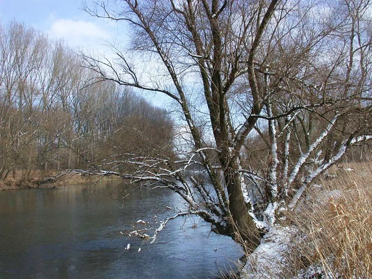

In February the riverside path through Bonn's Rheinaue is a row of lamp posts standing in brown water, and the city's flood bulletin names the Heimkehrerweg outright. By May the same stretch is mown, dry and full of prams. Bonn's landscape is partly on loan: the Rhine takes a slice of it back most winters and hands it over again in spring, and once you can read the gauge, that cycle becomes something you can plan a weekend around.
Reading the river before you choose a path
The sensible first stop is Alter Zoll (Altstadt, on the bluff above the Brassertufer), the bastion terrace where the old customs post looked down on the shipping. It is free, ungated and open all year, and wide enough to absorb a tour group without anyone being edged toward the parapet; the city's own Rhine walks use it as their meeting point. It has also just become easier to reach. The first rebuilt section of the Rheinuferpromenade, running from Josefstraße to Alter Zoll, opened on 12 September 2026, with phase two starting late in the year, so expect hoarding and works signage close by, and a slightly reduced walking width in places.
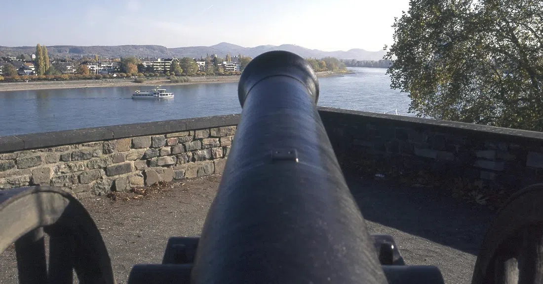
Cross to the right bank and the story changes register. The Beueler Rheinuferpromenade (Beuel, right bank) is the engineered answer to everything unruly on the far side of the water: rebuilt after the 1993 flood and dimensioned for a 9.50m reading on the Bonn gauge, with playgrounds strung along it and a continuous 29km of promenade across the two banks, so a group can walk out along one side and return by bridge or ferry. Look for the old high-water marks recorded on the Mehlemsches Haus nearby. 1784's catastrophic ice flood is cut at 14.23m, which tells you that 9.50m is an engineering decision rather than a ceiling the river has agreed to.
Three gauge readings govern the rest of this article. At 6.20m to 6.40m on the Bonn gauge the Rhine ferry at Mondorf stops running. As the gauge upstream approaches eight metres, the island park at Grafenwerth goes under. At 9.50m the Beuel wall is doing exactly the job it was built for. Our Bonn guide handles the city-side essentials; this piece is about the ground that keeps moving.
The park that was farmland before it was a garden show
Freizeitpark Rheinaue (Gronau and Hochkreuz, spanning both banks) is where the whole story is easiest to grasp, because it is farmed floodplain that was turned into a park for the 1979 Bundesgartenschau and never stopped behaving like floodplain. There are 45km of paths, no fence and no closing time, and it costs nothing; only the car parks charge. It is the one entry here that suits every kind of visitor at once: school classes, seniors' groups and coach parties are explicitly catered for, prams and dogs are routine, and the park's facilities take group reservations. Couples wanting quiet should walk away from the central lawns toward the river.
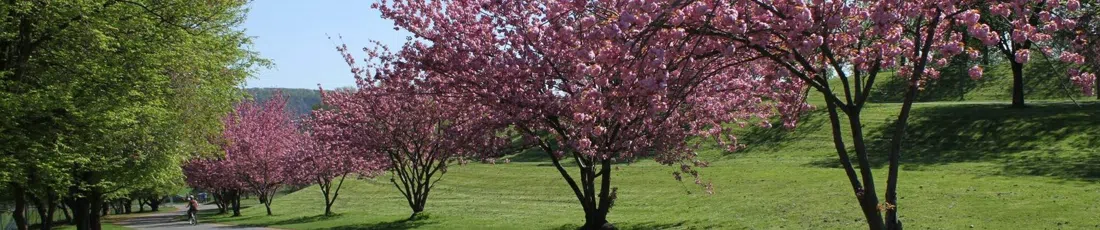
That riverside edge is the honest part. The stretch including the Heimkehrerweg goes under when the Rhine rises, which is why the city names it in flood bulletins rather than leaving walkers to find out. In a wet winter you stand at the top of the slope and watch benches and signposts standing in the current; six weeks later, after the silt has been scraped off, the same path is a cycling commute. None of it is dramatised. It is a park that accepts an annual eviction.
If you would rather have the seam explained than guess at it, the Bonn-Information Rheinspaziergang ins ehemalige Regierungsviertel (departs from the K-D ticket house at Brassertufer) is the city's own guided walk, linking the urban bank to the Rheinaue, which is precisely the transition this article is about. Public departures run at 16:30 and are seasonal, May to September, at €13 adult and €7.50 reduced. Outside those months, which includes now, the useful option is the private booking at €120 for a group: you choose the date, the time, the language and the emphasis, which makes it the only entry here guaranteed to run in your own language on your own schedule.
Where the Sieg arrives and the water goes
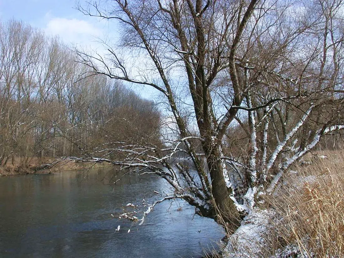
North of the city, the Sieg comes in through the one landscape on this list that really does disappear. Naturschutzgebiet Siegmündung (Mondorf, right bank, downstream of the centre) has been protected since 1986 and covers something between 450 and 535 hectares depending on the water, with around 240 bird species recorded, among them kingfishers along the cut banks and orioles and golden-green woodpeckers in the willows. Walk in along 'Auf dem Eiländchen' from the Mondorf ferry harbour; there is parking on Hafenstraße. Guided groups are welcome, but the station's requests are not decorative: stay on the marked paths, keep dogs leashed, and do not swim. Much of what you are looking at is a nursery.
Immediately alongside, Rheinaue Mondorf (Mondorf) is a reminder that none of this is accidental. Its pollard willows had almost gone once nobody cut willow wood for a living any more; the local NABU branch propagated the present stand from prunings in the mid-1980s, and the hollows of those trees now hold little owls, woodpeckers, bats and dormice. The paths are flat and easy and work well for cycling groups, and the autumn maintenance days can be joined by arrangement. An afternoon of cutting willow is the least sentimental way to understand why the landscape looks like this.
Upstream on the Sieg, the Siegfähre Bergheim (Bergheim an der Sieg) turned a hundred years old in June 2026 and remains the only ferry on the river's entire 155km, a current-driven cable boat worked by one person and one of the oldest of its kind in Germany. It takes pedestrians and cyclists only, a handful at a time, so two couples cross in a moment and a coach party queues for half an hour. The fare is a euro or two in cash. Its season runs Easter to 3 October, which means it shuts just as the meadows begin to take water. Treat that closing date as the calendar of the place rather than something to work around.
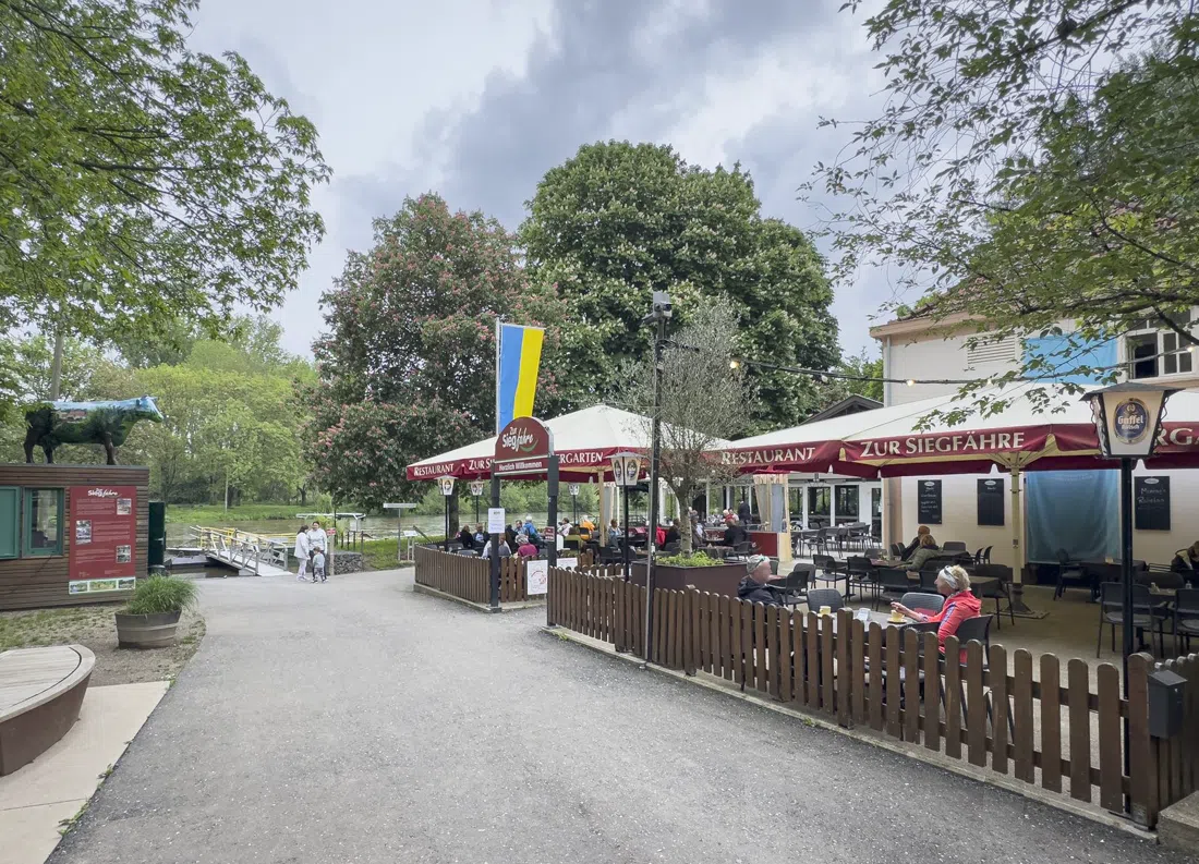
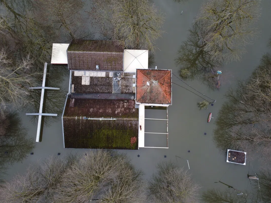
The same applies to Zur Siegfähre (Bergheim, at the crossing), the riverside inn whose large beer garden was clearly built for walking and cycling clubs. Mains run €12 to €22, it opens Tuesday to Sunday and closes Mondays, and parties should phone ahead. Be clear about the season, though: it hibernates from October to Easter alongside the ferry and the submerged pasture, so if you are reading this in autumn or winter, it is shut. Plan lunch in the city instead and save Bergheim for a spring crossing.
Two ferries, one of them already electric
The Rheinfähre Mondorf (Mondorf to Graurheindorf) is the cheapest way to feel the river's rhythm from on top of it. It runs Monday to Friday 06:00 to 21:00 and weekends 07:00 to 21:00, with a second boat at peak hours; crossing costs €1 to €2 on foot or with a bike and a few euros with a car, and walk-on or bike-on groups are no trouble at all. It was converted from diesel to electric at the Mondorf yard, which you notice mostly in the quiet. In high water it stops at 6.20m to 6.40m on the Bonn gauge, full stop. Right now the opposite problem is the live one: record low water has steepened the ramp angles, and since 7 August 2026 the boat has been limited to vehicles up to 7.5 tonnes. Foot passengers are unaffected.
For the wider view, Bonner Personen Schiffahrt eG (departures from the central city bank) runs scheduled, round and themed trips, with published group advice, discounts and whole-boat charter; a Siebengebirge round trip sits at roughly €15 to €25. Reading a flood plain from midstream is the one perspective walking cannot give you: the bend, the gravel bars, the way the willows stop exactly where the water usually reaches. One caveat, and take it literally: water level dictates the timetable, several upstream landings cannot currently be called at, and the operator's own advice is to check the day's departures rather than trusting a printed schedule.

Downstream, a meadow being put back
Rheinaue bei Hersel (Hersel, downstream of the city) is the place to watch restoration as a process rather than a finished result. The land was bought with environmental compensation money and put under livestock as conservation grazing, and the linked Natur-Kultur-Pfad divides into loops of one to two hours starting at Hersel, Uedorf and Widdig: short, flat, almost entirely surfaced, and therefore the easiest ground here for a walking group of mixed ability or anyone with a wheeled aid. The adjacent Herseler Werth reserve has been closed to all visitors since 1993, which is worth knowing before you look for a way in. There isn't one, and the view from the path is the intended experience.
The high seats that make the shape obvious
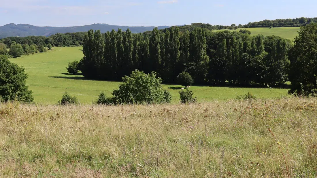
From ground level a flood plain is just a flat field. From above it is unmistakable. Naturschutzgebiet Rodderberg (Niederbachem, on the hills west of the river) is a crater, western Europe's youngest volcano at some 13,000 years and protected since 1927, and its 73 hectares of warm, dry grassland form a heat island carrying more than forty red-list species. Park at the hikers' car park by the Broichhofkapelle on Vulkanstraße. The climb is gentle enough for mixed groups, and from the rim you read the whole width of the plain at once.
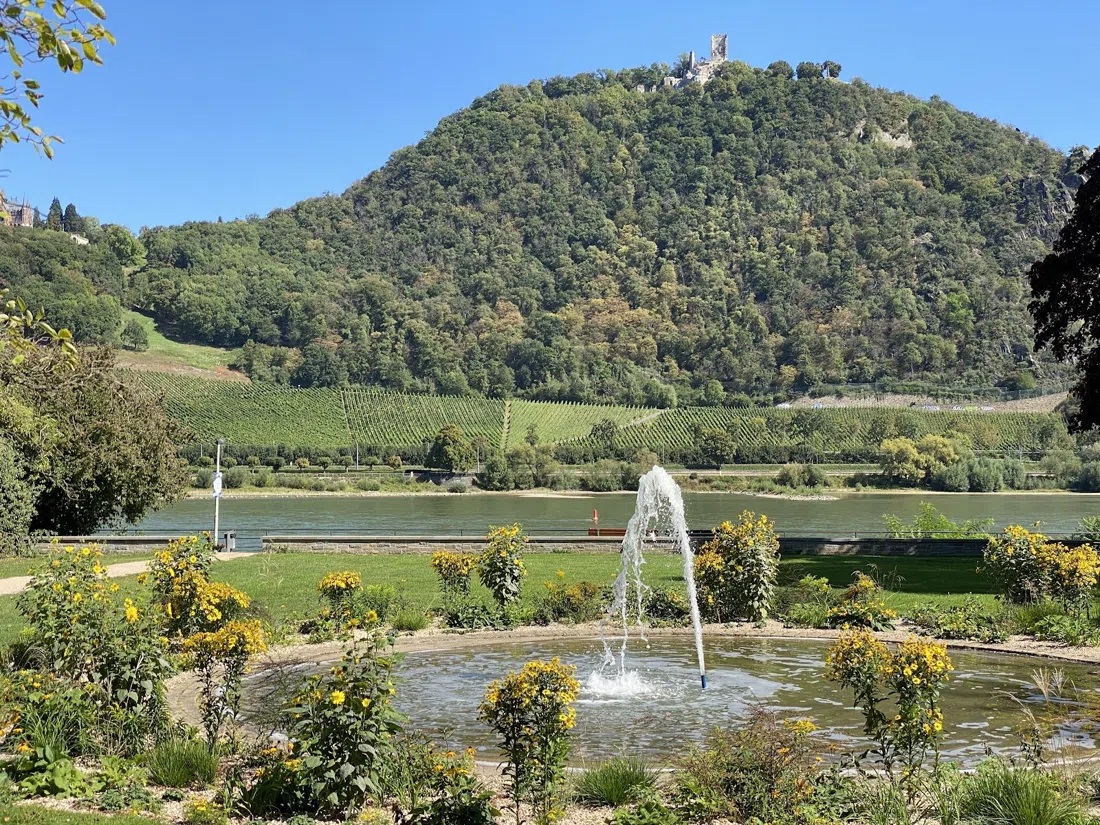
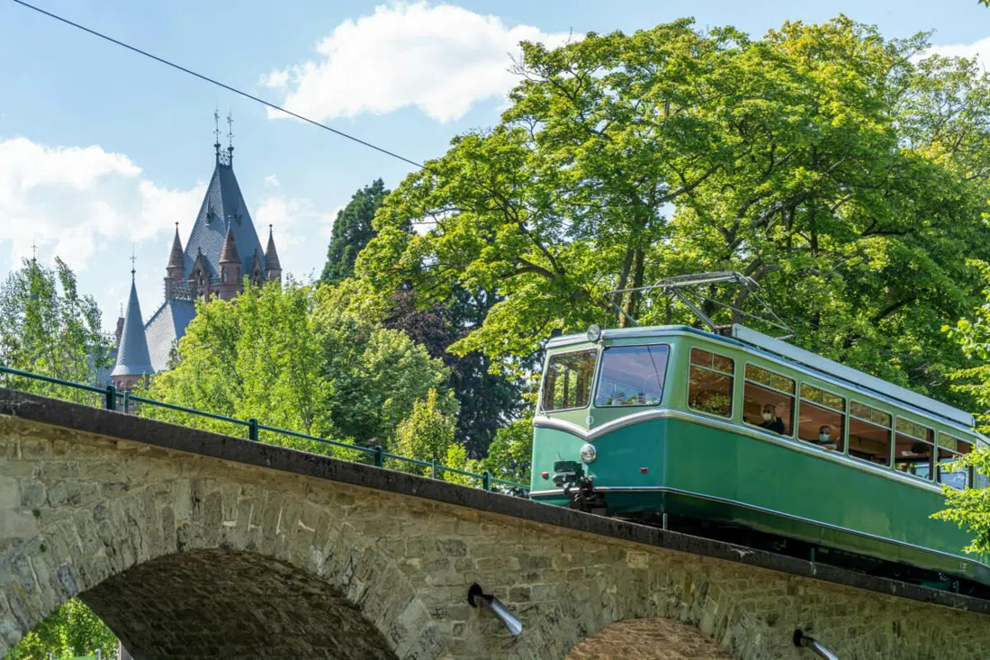
Across the water, the Drachenfelsbahn (Siebengebirge, east bank) is Germany's oldest cog railway still in service and the quickest altitude gain available: departures every 30 minutes from March to October, €12 adult return and €6 for children aged 4 to 13, with published group tariffs and a combined ticket that pairs it with the river boats, so it really is built for school and coach traffic. Midday in summer is crowded; early morning is not. The plateau gives you the bend, the islands and the full breadth of the plain in a single frame.
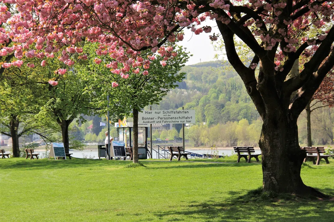
Insel Grafenwerth (island park upstream, reached by car, by line 66 to the end of the line, or by regional train) is the most literal version of the vanish-and-return story. Entry is free, prams and pets are fine, and the island is set up for school classes and all-ages groups. As the upstream gauge nears eight metres it floods, with the playground equipment partly dismantled ahead of warnings rather than left to be carried off. The raised path to the island's tip stays usable through ordinary high water, which makes a winter visit interesting rather than pointless. The outdoor pool, ticketed separately, reopened on 1 May 2026 and belongs to summer.
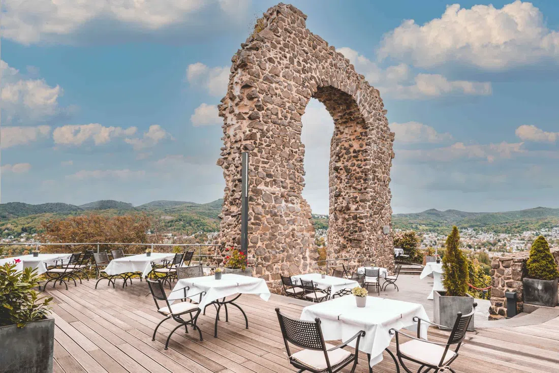
One place here earns a proper dinner with linen and a view, and it happens to have the subject on its terrace. Rolandsbogen (hillside above Mehlem, run by Lutter & Wegner) looks out at an island mid-channel with the flood plain spreading either side. It opens Wednesday to Sunday, 12:00 to 22:00, closed Monday and Tuesday; mains are €25 to €40; the terrace and garden take sizeable parties but reservation is essential, for two people as much as for twelve. It takes a winter break in January and February (it reopened on 1 March 2026), and you can walk up from Bonn-Mehlem, which is the honest way to arrive.
Going out with the people who manage it
If you want inside the story rather than beside it, Biologische Station Bonn / Rhein-Erft e.V. (Bonn and the surrounding Rhine and Sieg meadows) publishes a programme of excursions, courses and hands-on conservation days, mostly free or a small fee. Registration is required and demand regularly outstrips places, so book early and ask directly whether a given date can be run in English. Two fixtures show the range. The annual Kopfweidenschnitt, the willow-cutting in the Sieg flood plain, falls in late February, when the water is at its most assertive; talks such as 'the beaver returns to Rhine and Sieg' on 23 October 2026 explain why the plain is changing shape again. Ask them for the 2027 cutting date when you enquire, since it is published in advance.
Practical notes for the loop
Most of this is reachable without a car. The two-bank promenade plus the Mondorf ferry makes a natural half-day loop on foot or by bike, and the Siebengebirge cog railway and the upstream island sit at the end of a suburban rail and tram ride. The Rodderberg crater and the Bergheim crossing are the two that are genuinely easier with a car, and both have signed car parks.
Carry coins. The Sieg cable ferry wants a euro or two in cash, and the Rhine ferry fare is small enough that a card is not worth anyone's time. Park fees in the Rheinaue are the only other routine cost.
Late February to early April is the dramatic season: high water, the willow-cutting, bare trees, the paths you cannot use. May to September is when the ferries, the public guided walk and the inn all operate together. October to Easter is the shoulder that catches people out, because the Sieg ferry and Zur Siegfähre close completely and boat timetables bend to water level. The walking is still excellent if you have planned around them.
A full day of meadow walking costs almost nothing. The parks, the reserves, the crater and both promenades are free, the ferries are a couple of euros, and a city walking tour is €13. Add €12 for the cog railway, €15 to €25 for a river round trip, €12 to €22 for a beer-garden lunch in season or €25 to €40 for the view dinner. Base yourself near the city bank so the Rheinaue and both ferries stay within walking or cycling reach. The Bonn hotel search covers the central and Beuel options, and sleeping on the Beuel side puts you on the promenade before anyone else is awake.